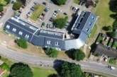
 Drones land multi-million-pound savings for local authority social housing portfolio. The story behind the successful implementation of drones across Renfrewshire Council’s estate and how a chance enquiry turned into a pioneering use case for council’s UK-wide by Glasgow-based drone survey specialist Neil Mowbray, from Terraocean.
In the early days of the drone industry there were many websites where people would post a requirement for drone work and the operators would submit bids in the hopes of winning. I was a member of the largest network. To be honest, it hadn’t really ever provided any decent opportunities but on one occasion a bid offer was posted for a job one mile from my office, it was a quiet morning, so I responded. The job was a simple roof survey of a two story, four-unit post-war dwelling, very typical of the west of Scotland. I submitted my bid, they client responded very quickly with the address
of the property and the time they would like me to attend site.
I arrived to find many official-looking people milling around in hi-viz. It transpires that the client was in fact the Housing Asset & Energy Strategy Manager at Renfrewshire Council and this was a test project for a much larger programme of works they had in mind to allow them to gather data on the condition of their entire housing stock over a multi-year period.
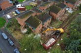
The specific property we were there to inspect was built on a relatively steep incline, so scaffolding was not possible, and the type and size of MEWP (mobile elevating work platform) required was prohibitively expensive. The client had read about the use of drones for inspection and wanted to try.
After all relevant permissions were granted and safety measures put in place, the survey took under 10 minutes to digitally capture ultra-high resolution imagery, which the local authority’s own surveyors could review and assess. The method was approved, and a two-year programme of works was put in place to perform drone surveys.
Stock condition surveys
Renfrewshire Council owns roughly 12,000 properties in their social housing portfolio, which consists mainly of two- to five-story low-rise post-war type accommodation and 14 high-rise towers, all of which require regular maintenance. Due to the age of the properties, a large-scale roof replacement programme had been planned (tiles usually have a 25–35-year life span) but stock condition surveys need to be carried out before any work could commence.
Until 2016, the council had been using MEWP’s and scaffolding to perform inspections. This method is slow and costly; at today’s prices, an appropriately sized MEWP costs more than £1,000/day with the ability to complete four to five properties in that time, assuming they are close to each other. Scaffolding is another matter entirely whereby it can take between four and six days to erect, inspect, and dismantle, costing many thousands of pounds per property. Compared to a single drone survey, the time savings are up to 97% and the cost savings are 85% per property.
Although the cost savings on performing the actual surveys are considerable, the major savings for the local authority have been through the ability to access the necessary data quickly and then allocate funds accordingly. Previously, the standard procedure had been that a roof tile with a 30-year life span would be slated to be replaced at the end of its advertised life span, however the data collected by drones allowed the council to assess the health of the roof structure and decide to maintain for another two, five or 10 years.
At an average cost of £16,000 per roof replacement, this method allowed the council to save over £4m in that year alone and allowed an entire programme of inspections to be carried out in less than two months with no disruption to tenants.
For information opn ARPAS-UK and its services visit www.arpas.uk
For information on Connected Places Catapult and its servises visit https://cp.catapult.org.uk/
