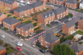
A groundbreaking new mapping tool, OneMap, has officially launched, marking a major step forward in how social housing providers across the northeast of England collaborate, plan, and deliver services.
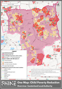
Developed through the SHINE (Social Housing Innovation North East) partnership, OneMap is a shared Geographic Information System (GIS) platform that brings together open-source data, publicly licensed datasets, and partner-owned information to create a powerful, location-based decision-making tool.
It includes property-level data such as EPC ratings, build year, construction year and home type, alongside layers covering anti-social behaviour, demographics, deprivation indices, flood risk, climate hazards, and environment.
The project is the result of close collaboration between a number of SHINE members — believe housing, Bernicia, Darlington Borough Council, Gentoo Group, Karbon Homes, North Star, Places for People, and Thirteen Group. By pooling data and resources, these social housing providers are unlocking new efficiencies and insights that are expected to benefit thousands of social housing tenants and residents.

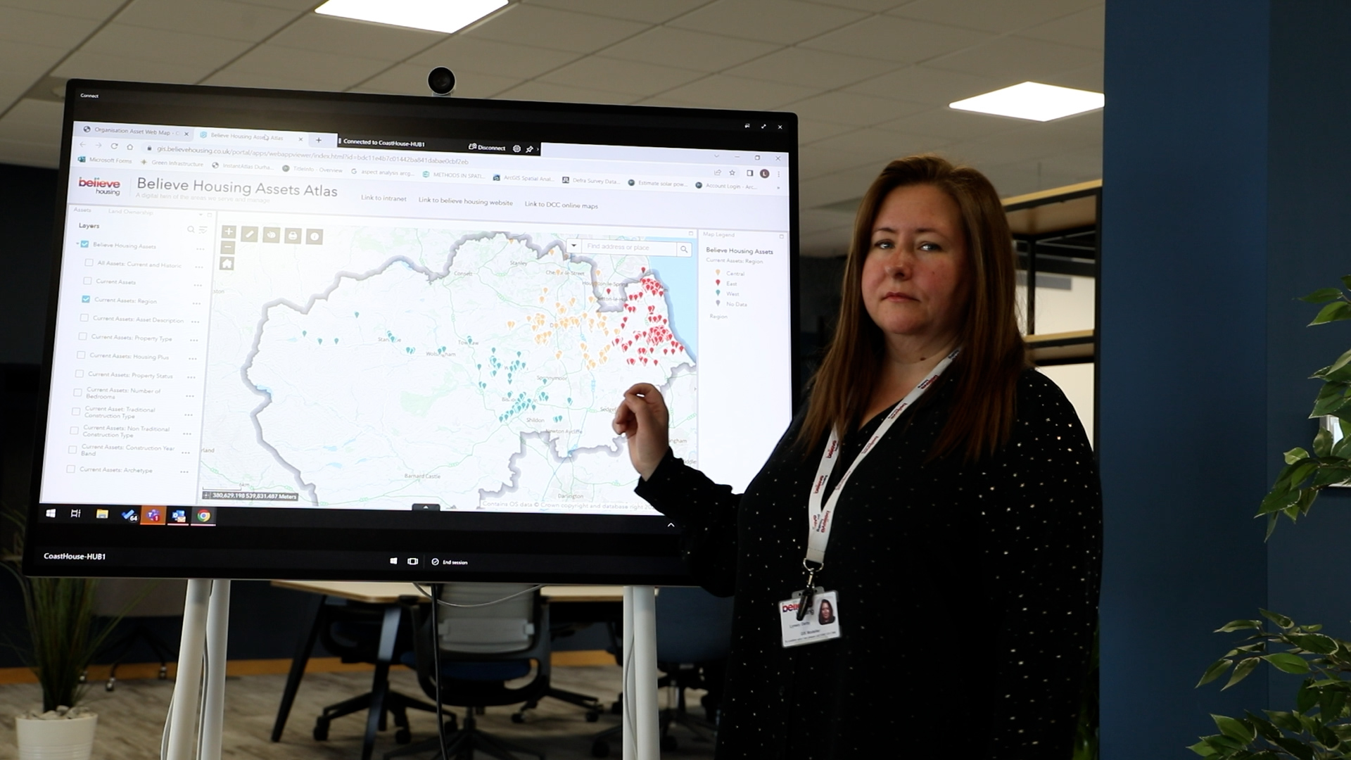
“OneMap is an easy-to-use tool, specifically designed to facilitate collaboration between social housing providers,” said Lynsey Darby, GIS Specialist at believe housing.
Lynsey has played a central role in developing OneMap, leading a regional group of GIS specialists and data analysts known as the GIS Club to turn the original prototype into a fully functioning application. Her work was recognised earlier this year when she was named Innovator of the Year at the 2025 Housing Digital Innovation Awards.
Lynsey added: “Without knowing where other providers’ properties are located, it’s easy to work in silos, unintentionally creating invisible boundaries that affect customer experience and service delivery.
“OneMap helps break down those barriers and enables us to build targeted, cohesive plans based on accurate, shared data.”
Already, OneMap is being used to coordinate some investment programmes, including joint planning for home energy improvement works. In areas where multiple landlords operate on a single estate, this shared approach makes sense for both residents and landlords.
The tool is also supporting targeted service delivery. For example, a pilot employability project led by believe housing, Bernicia, Karbon Homes, and North Star is using OneMap to identify areas where women aged 50 to 65 are most likely to be out of work.
 The map has helped to pinpoint priority areas in Bedlington, southwest Durham, and Pallion in Sunderland, using deprivation and health data to guide funding bids and outreach.
OneMap is also being used to support early work on tackling child poverty across the region, helping SHINE members identify areas where targeted support could have the greatest impact.
The concept for OneMap was first developed in just five days at the Northumbrian Water Ltd Innovation Festival in July 2024. Since then, the GIS Club has worked to turn the prototype into a fully functioning application using ESRI’s ArcGIS Online platform.
Alan Smith, Chief Executive of believe housing, said: “OneMap shows what’s possible when housing providers work together. By sharing data and insight, we can make better informed decisions that improve services and create real value for our customers. It’s a great example of collaboration driving innovation and helping us all work more efficiently for the communities we serve.”
Matt Forest, CEO of Thirteen Group and Portfolio Lead for Asset Management for the North East Housing Partnership, commented: “As a former geography teacher I love this cartographic collaboration – it’s the kind of collaboration we had in mind when we formed the partnership.
“In our region you can have six or seven different providers owning homes in an area as small as one square kilometre, which brings its challenges when you’re looking to plan and deliver investment and services in a coordinated way.
“Having a tool like OneMap gives us a full picture of our stock ownership across the region, and that intelligence means we can join up our plans, make better decisions, and most importantly, maximise the positive difference we can make for our customers.”
Isabel Clouting, from ESRI UK, added: “Housing is a location-centric industry, and it’s brilliant to see multiple organisations coming together to work smarter with GIS at the centre. The energy and collaboration at the launch event showed just how important this is for the sector.”
With growing interest and more data contributors expected, SHINE members believe OneMap can evolve to become an even more valuable resource for improving services, targeting investment, and delivering better outcomes for communities across the northeast of England.
Header image: Lynsey Darby, GIS Specialist at believe housing